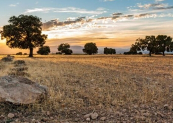
The South African Weather Service (SAWS) has issued a seasonal forecast indicating that the upcoming summer season is likely to bring above-normal rainfall across much of the country.
While this presents opportunities for improved water availability, experts warn that it also increases the risk of flooding, waterlogging, and crop stress in some regions.
Wetter-than-normal conditions are expected to develop toward mid-summer, especially across the eastern interior, including parts of North West, Free State, KwaZulu-Natal, and the Eastern Cape.
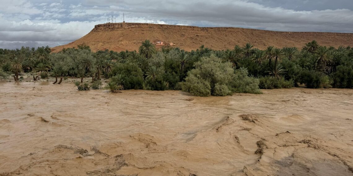
However, rain and hail have already wreaked havoc this past weekend, and the South African Weather Service has already issued severe thunderstorm warnings for 20 to 22 October across parts of the North West, Northern Cape, and Free State.
A yellow level 2 warning is in place for the North West, extreme north-eastern Northern Cape, and extreme north-western Free State, with localised damage to infrastructure, property, and livestock expected, along with flooding of low-lying areas and roads. A more serious yellow level 4 warning has been issued for the western parts of North West, where heavy rainfall could lead to flooding, road closures, and loss of agricultural production.
“The forthcoming summer season will likely be wetter than normal, with the probability of above-normal rainfall increasing towards mid-summer,” the SAWS said.
According to the Climate Prediction Centre (CPC/NCEP/NWS), La Niña conditions are currently present and expected to continue through December 2025 to February 2026, with a 55% chance of transitioning to El Niño–Southern Oscillation (Enso)-neutral between January and March 2026.
SAWS noted that for South Africa, this generally translates into “favourable rainfall conditions for the summer rainfall areas in the north-eastern parts of the country, although it may also increase the likelihood of flooding during summer.”
Related stories
- Climate finance, trade top agenda at G20 ministerial meeting
- Drought to floods: Climate crisis hits Pietermaritzburg hard
- Indigenous crops: The climate-smart superfoods we need
- Science meets soil: Agronomist turns manure into climate solution
Preparing for a changing climate
At the recent Atlas AgriSA Congress, Dr Christien Engelbrecht, meteorologist at the SAWS, shared a broader outlook on Southern Africa’s changing climate.
“It’s likely to become generally dry and at the same time this region is certain to become drastically warm, especially if the future, or under the assumption of course, that we keep on emitting greenhouse gases at the current rates of emissions, so under so-called low mitigation futures,” she said.
She warned that a generally drier future and a much hotter future for Southern Africa is really bad news because it is a water-stressed region, and when a water-stressed region becomes much warmer and likely drier, the options for climate change adaptation are really limited.
Engelbrecht highlighted that while many regions face increasing drought and heat stress, the eastern escarpment, including the Drakensberg and KwaZulu-Natal, presents a more complex outlook.
About half of climate models project a wetter future, and the other half a drier one, but nearly all agree that extreme rainfall events will become more frequent. These intense events are expected to bring heavy downpours and flooding similar to the April 2022 and June 2025 Mthatha floods.
“So indeed, over eastern South Africa, we need to prepare increasingly for flood risk. We are speaking of really intense rainfall events caused by cut-off lows, a certain type of weather system that many of our farmers will know much about because it’s so important in terms of bringing rainfall to the Eastern Cape and KwaZulu-Natal, sometimes over the interior. But that type of weather system is becoming more dangerous,” Engelbrecht said.
Soil management vital
Engelbrecht explained that as the Indian Ocean warms, evaporation into the atmosphere increases, making weather systems more powerful and capable of bringing heavier rainfall.
“In central Southern Africa and the western parts, it’s certainly about more long-lasting, more intense droughts and much more intense heatwaves than we are used to. We can already expect unprecedented heatwaves occurring in the next 10 years compared to the last 10 years,” she said.
Soil scientist Peter Mudau advised farmers to pay close attention to their soil types and drainage capacity during this high rainfall period.
“La Niña season is those times of growing crops in above-normal rainfall. Farmers need to be aware of the type of soils they have and how to manage the planting schedules.
“It would be advisable for farmers to monitor soil water content in their fields to introduce strategies that will mitigate excess water in their fields and further assist with improving crop performance,” he said.
READ NEXT: How to cut costs and boost income with agroecology