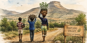
The Food and Agriculture Organization of the United Nations (FAO) has been recognised for its innovative work in helping Zimbabwe harness satellite technology to improve agricultural data and disaster response. The organisation was announced as the winner of the SDG Custodian Agency Prize at the prestigious seventh annual GEO SDG Awards held on Wednesday in Rome.
The award celebrates outstanding efforts in using Earth observation technologies to drive progress toward the United Nations Sustainable Development Goals (SDGs). It was presented by the Group on Earth Observations (GEO), an international partnership that coordinates open-data initiatives from more than 100 countries and key institutions like NASA and the European Space Agency.
FAO’s award-winning project, launched in 2023, supported Zimbabwe in building a national crop monitoring system that uses satellite data to generate official agricultural statistics and strengthen the country’s capacity to model floods and droughts. The initiative is part of FAO’s Earth Observation for Statistics (FAO-EOSTAT) programme, which has already rolled out similar projects in over 20 countries.
“This multi-faceted initiative is a model for sustainable EO integration into national statistical systems, contributing directly to SDG indicators and to the resilience of Zimbabwe’s agriculture sector,” said Lorenzo de Simone, project leader for FAO’s EOSTAT initiative.
The project’s accomplishments are already tangible. Among its successes is the creation of Zimbabwe’s first national winter wheat map, covering 28 districts.
Related stories
According to FAO, the map boasts a 95% overall accuracy rate and 96% precision in identifying wheat crops, a significant achievement for national crop monitoring. Additionally, the initiative produced the country’s first comprehensive summer crop map, classifying 14 major crops with 77% overall accuracy, thanks to data from the European Space Agency’s Sentinel-2 satellites and the Sen4Stat system.
Beyond mapping, the project introduced a High-Resolution Drought Monitoring System tailored to Zimbabwe’s specific crops and climate. This tool enables field-level analysis of drought severity, providing valuable insights to mitigate the impact of dry spells on farmers and national food security.
Satellite data and local expertise
A prototype Farmer Registry System is also in development under the project. This system links field boundaries with social and crop data, offering policymakers a powerful tool to monitor agricultural productivity, track subsidy allocations, and assess the effectiveness of government support programs.
Importantly, the initiative goes beyond technology by building human capacity. More than 25 national experts from Zimbabwe’s statistics agency, ZIMSTAT, and other government ministries have received specialised training in integrating Earth observation data into their agricultural monitoring and reporting.
The country’s newly developed survey framework and data collection protocol for crop type mapping are expected to further institutionalise these improvements.
A national “Mapathon” co-hosted with the National University of Science and Technology contributed to the digitisation of over 200 000 crop fields across seven districts, showcasing how local participation and technology can be combined for better agricultural data.
FAO’s work in Zimbabwe aligns with its broader mission to leverage digital innovation for “better production, better nutrition, a better environment and a better life for all,” echoing its commitment to leaving no one behind in the pursuit of sustainable development.
The award underlines the growing importance of geospatial technologies in modern agriculture, especially for countries like Zimbabwe that are highly vulnerable to climate shocks. By strengthening data systems and boosting predictive capacities, the project offers a pathway for more resilient farming systems in the face of droughts, floods, and other climate risks.
As countries across Africa continue grappling with the challenges of climate change, food insecurity, and evolving agricultural landscapes, FAO’s initiative in Zimbabwe could serve as a blueprint for similar efforts elsewhere on the continent.
READ NEXT: Zimbabwe breadbasket myth: A zombie idea that won’t die
Sign up for Mzansi Today: Your daily take on the news and happenings from the agriculture value chain